SHARE


 Peru
Peru
19-05-2017 | di COOPI
From information to actions: a new GIS platform
Over the past few months COOPI developed a Geographical Information System platform (GIS) in Lima, in the framework of the project "Reinforcing innovative mechanisms for arising capacities in Disaster Risk Reduction in Rímac", funded by USAID/OFTA.
GIS enables to visualize the main threats and vulnerabilities in the object areas to foster crisis management by turning information into actions. The innovative aspect of the program run by COOPI in Lima is the participatory methodology for data collection, which aims at assessing the needs in a more comprehensive way by involving several stakeholders, from Local Authorities to Institutions and organizations at different levels.
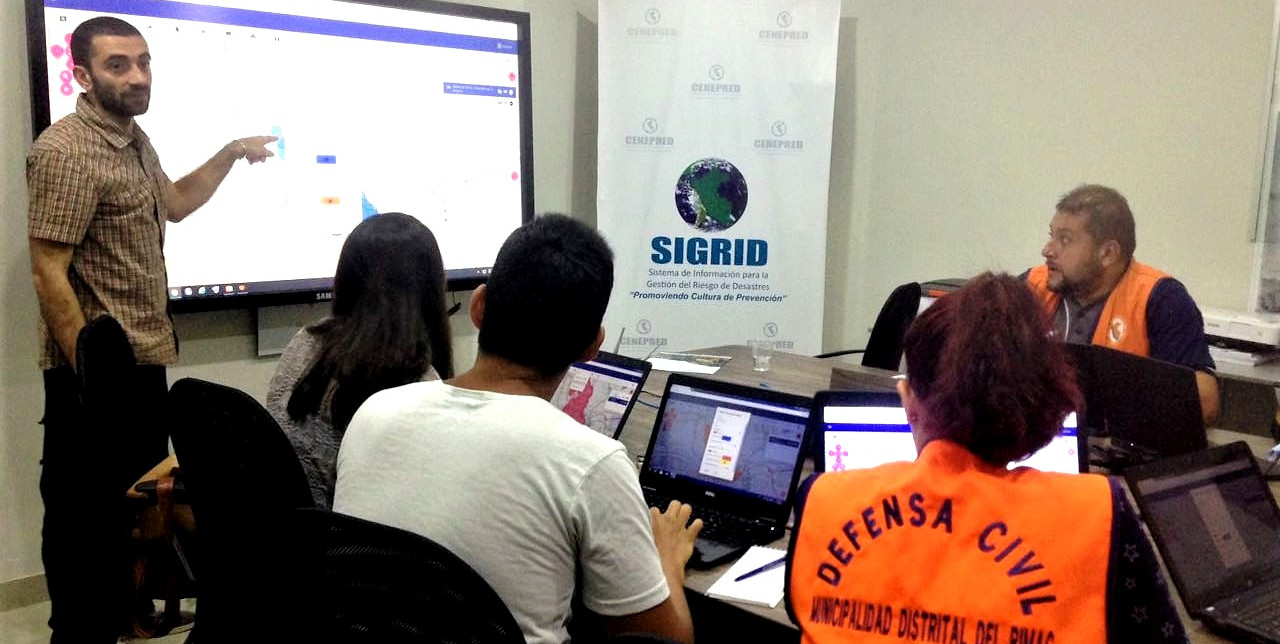
Yet another GIS online
From 19th to 27th of April, Gnucoop, a Cooperative of IT and Development professionals that provides IT support particularly to NGOs and not-for-profit institutions, has been in Lima for presenting and installing the project Yago (Yet Another GIS Online) in the CENEPRED's server, in support of COOPI and its RIMAC DRR project, a Disaster Risk Reduction project in an urban context.

The purpose of the mission was the training on the use of Yago, a modern and light software that can also run on smartphones and tablets, to the Municipality of Rímac staff and to CENEPRED staff. Yago will be an important tool for the Municipality of Rímac to include the spatial component in its decision making process.
The training was directed to some technicians from Municipality and CENEPRED, which will be responsible for the quality check of the data collected by the Municipality's officers, and to one IT technician who will follow the future development of the platform. All the participants were really enthusiastic of the platform and they actively participated to the training.
COOPI will organize in the next weeks a presentation event to disseminate Yago and the importance of including the use of spatial data in the daily works of the Municipality. The event will be directed to the large public to disseminate YAGO and the inclusion of the SIG in the decision making process.